Topographical surveys are required for a variety of reasons such as the development of green field sites, planning applications, boundary surveys, urban projects and for many other design and build purposes.
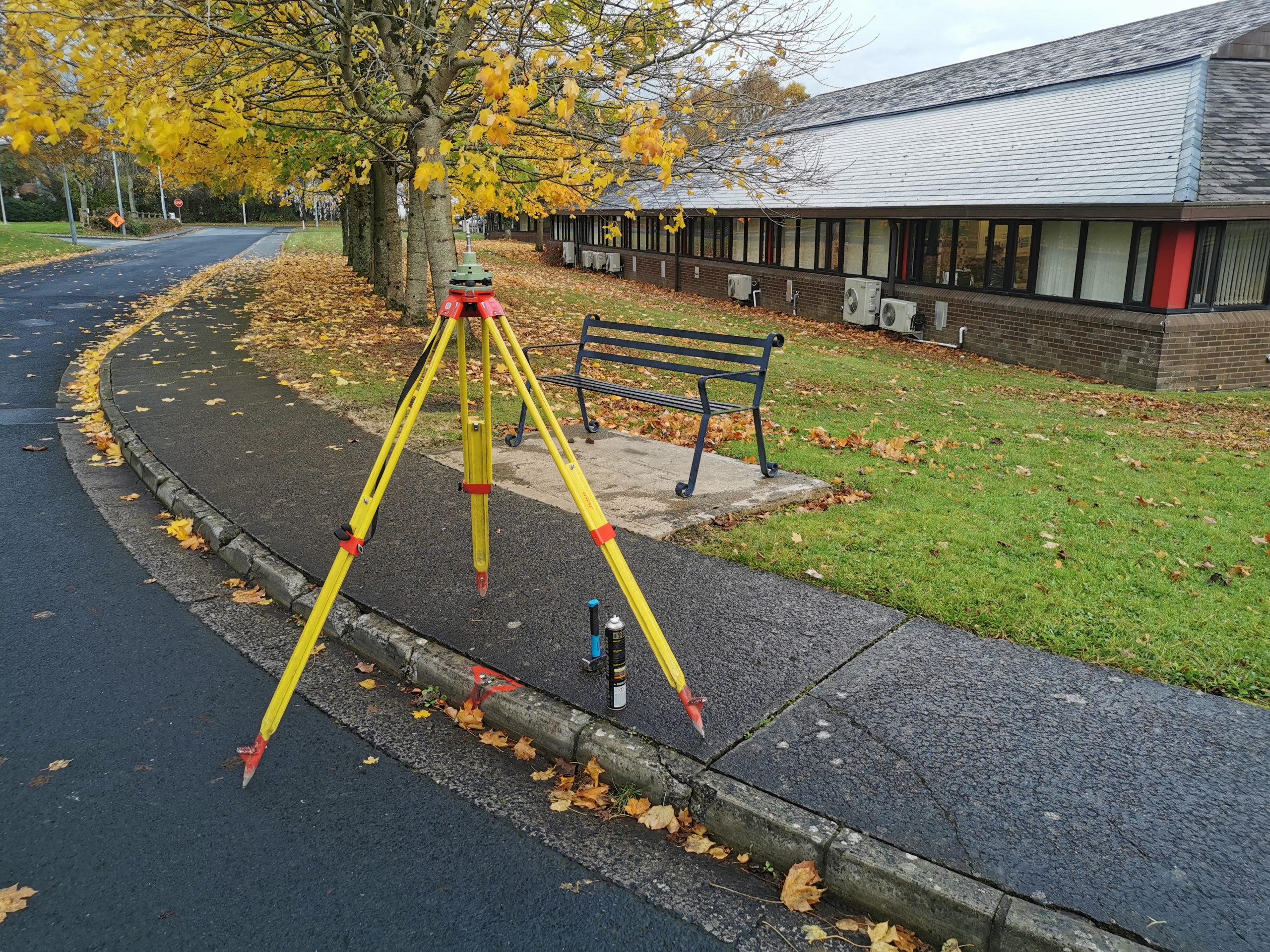
There is a high degree of detail involved in this type of survey. All natural features such as trees, earth mounds, water courses and high/low points along with man-made features such as roads, fences, paths and services are surveyed using the latest technology available namely GPS and Robotic Total Stations. Survey detail such as ridge and eaves heights as well as building positions can be recorded on neighboring properties without requiring access using Reflectorless Total Stations.
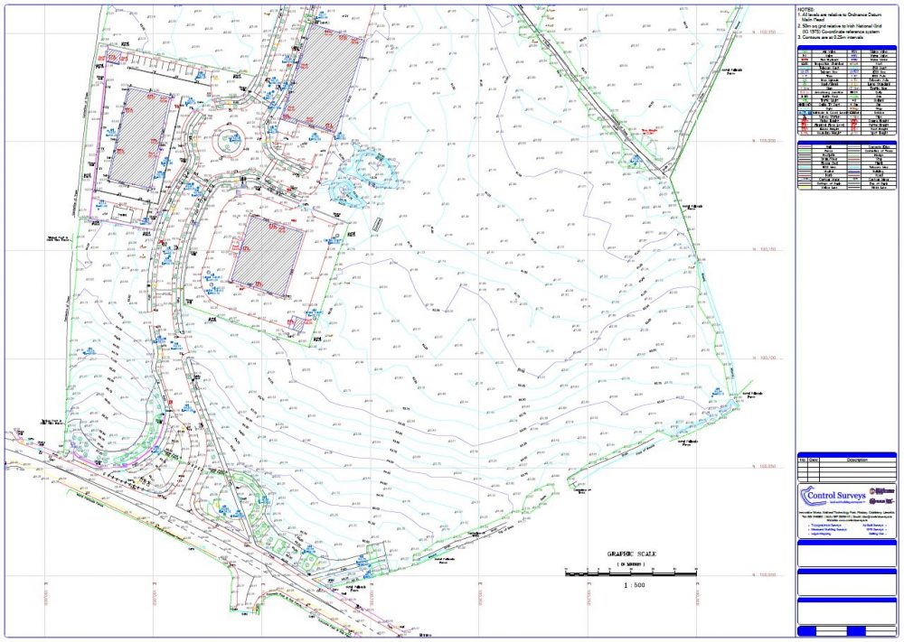
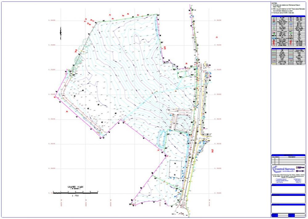
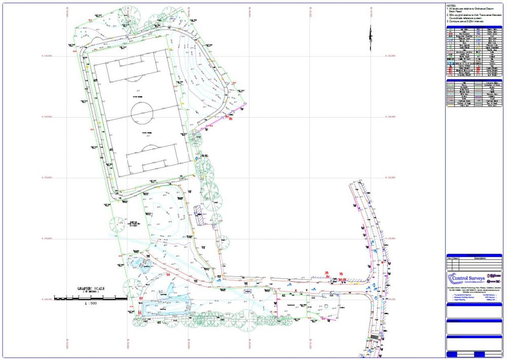
The data collected is processed using dedicated mapping software where all computations, terrain modelling and final editing are quickly carried out to produce the end product; a topographical map which provides a comprehensive depiction of the surveyed features using contours, texts, symbols and spot levels.
Maps can be produced to a variety of scales and as standard all surveys are tied to the Ordnance Survey coordinate system ITM and Malin Head Datum. Surveys can be delivered to the client in multiple digital formats and can be customized to meet specific requirements of each individual client.