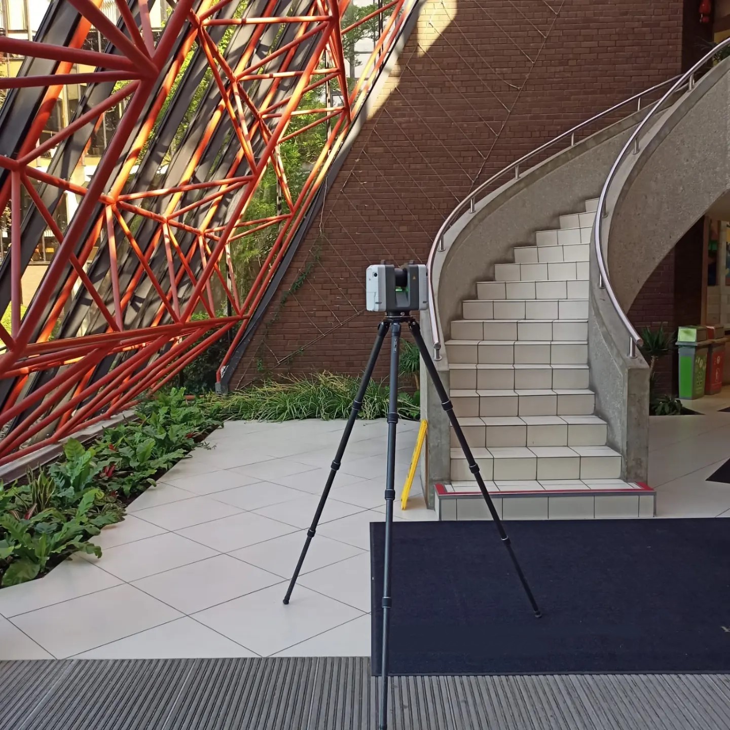
Laser Scanning captures the complete three-dimensional geometry of an area to be surveyed by recording millions of measurements per second along with high resolution 3D photography. A huge amount of data can quickly and easily be collected over a relatively short period of time to survey grade precision.
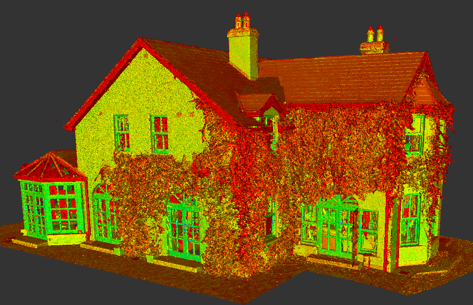
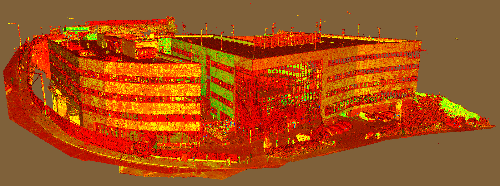
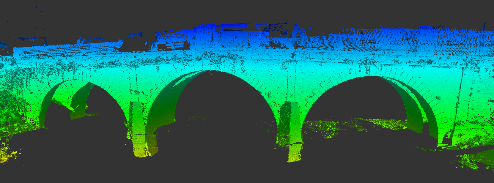
The 3D survey points and images collected are combined together to produce a detailed and highly accurate point cloud that represents the survey area. Some of our clients prefer to work with the point cloud themselves and we can provide the data in multiple file formats in monochrome or colour and positioned to real world co-ordinates using GPS. More often we use these point clouds to provide the accurate platform for extracting traditional 2D Cad deliverables such as building floor and roof plans, elevations and sections.
Laser scanning has numerous advantages over traditional survey techniques:
- Reduces project times and is less intrusive due to a fast turnaround and no requirement for physical contact with the survey area.
- Rapid completion of a survey where access time is restricted.
- Ideally suited to areas which are relatively inaccessible, have poor lighting and are hazardous.
- Avoids potential site revisits for missed data and allows the client to amend the scope of the survey at a later date as all the details have been surveyed.
- Provides an archival record of a given site.
- Particularly suited to structures with a high level of detail such as historical buildings and pharmaceutical plants